


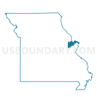
091-Katy Trail Voting District, St. Charles County, Missouri
About
Outline

Summary
| Unique Area Identifier | 609671 |
| Name | 091-Katy Trail Voting District |
| County | St. Charles County |
| State | Missouri |
| Area (square miles) | 2.57 |
| Land Area (square miles) | 2.56 |
| Water Area (square miles) | 0.01 |
| % of Land Area | 99.80 |
| % of Water Area | 0.20 |
| Latitude of the Internal Point | 38.73303910 |
| Longtitude of the Internal Point | -90.55330640 |
Maps


Graphs
Select a template below for downloading or customizing gragh for 091-Katy Trail Voting District, St. Charles County, Missouri


Neighbors
Neighoring Voting District (by Name) Neighboring Voting District on the Map
- 015-Washington Voting District, St. Charles County, MO
- 080-Heritage Voting District, St. Charles County, MO
- 083-Woodcliff Voting District, St. Charles County, MO
- 084-Harvester Voting District, St. Charles County, MO
- 086-Arlington Voting District, St. Charles County, MO
- 100-McClay Voting District, St. Charles County, MO
- 220-Pitman Voting District, St. Charles County, MO
- MHT037 Voting District, St. Louis County, MO
Top 10 Neighboring County Subdivision (by Population) Neighboring County Subdivision on the Map
- Maryland Heights township, St. Louis County, MO (36,370)
- Frontier township, St. Charles County, MO (26,850)
- Harvester township, St. Charles County, MO (20,573)
- Spencer Creek township, St. Charles County, MO (20,198)
- St. Peters township, St. Charles County, MO (18,256)
Top 10 Neighboring Place (by Population) Neighboring Place on the Map
Top 10 Neighboring Unified School District (by Population) Neighboring Unified School District on the Map
Top 10 Neighboring State Legislative District Lower Chamber (by Population) Neighboring State Legislative District Lower Chamber on the Map
- State House District 15, MO (40,041)
- State House District 79, MO (34,555)
- State House District 16, MO (34,474)
Top 10 Neighboring State Legislative District Upper Chamber (by Population) Neighboring State Legislative District Upper Chamber on the Map
Top 10 Neighboring 111th Congressional District (by Population) Neighboring 111th Congressional District on the Map
Top 10 Neighboring Census Tract (by Population) Neighboring Census Tract on the Map
- Census Tract 3111.48, St. Charles County, MO (4,517)
- Census Tract 3111.46, St. Charles County, MO (4,416)
- Census Tract 3112.11, St. Charles County, MO (4,386)
- Census Tract 3111.45, St. Charles County, MO (4,256)
- Census Tract 3110.01, St. Charles County, MO (4,049)
- Census Tract 3111.47, St. Charles County, MO (4,039)
- Census Tract 3111.49, St. Charles County, MO (3,737)
- Census Tract 3112.21, St. Charles County, MO (3,683)
- Census Tract 2151.05, St. Louis County, MO (2,349)